
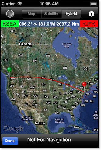
Displays a representation of the calculated great circle route between the from and to waypoint coordinates. If the track crosses the 180° meridian the view will not centre over the middle of the track and you will need to scroll the map left or right to see both points. Pressing a map pin will reveal a display of the magnetic track, coordinates, and a button that will zoom to the pin location. Pressing the button again will display the next pin location. Pressing the current location button (upper left hand corner) will turn on the current position locator. After the blue dot appears pressing the button on and off again will zoom into your position and keep the position centred in the screen. This feature also requires an internet connection and is not available in flight.
Notes:
Zoom into your track while connected to the internet and then “walk” the trip all the way to your destination. Most of the map tiles will be stored for you to view once offline as long as you maintain the same zoom level.